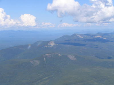
Near Steamboat Pass:
 Near Summit Lake Pass:
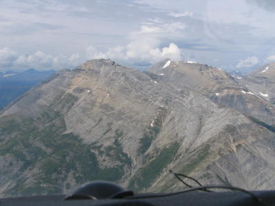
 Around Alaska Highway Mile Marker 422:
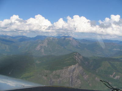
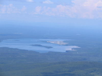
Seen near Muncho Lake at Highway Mile Marker 462:
We landed at Watson Lake, a wonderful airport sitting right on you guessed it right Watson Lake. The approach involves a flight over the edge of the lake, so I kept her a bit high just in case. I had the runway from at least 20 miles out. You would too, even if you weren't a grizzled ol' bush pilot like the IFR Pilot:
 One of the classic images of Watson Lake Airport is the building that formerly housed the B.C.-Yukon Flying Service, Ltd. Build during World War II, when Watson Lake was a stop on theNorthern Staging Route for delivery of planes to Russia under the Lend-Lease Program, the buildinghas now begun to fall into disrepair.
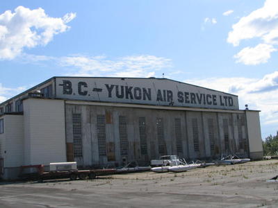 Of course, if you go to Watson Lake, you must see the Sign Post Forest. Don't know what that is? OK, here's the story, right from the horse's mouth:
 Images of the sign post forest:
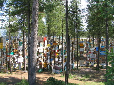
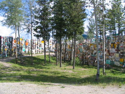
At last count, nearly a year ago, there were over 54,000 signs in the forest. We found this one, whichstruck a chord:
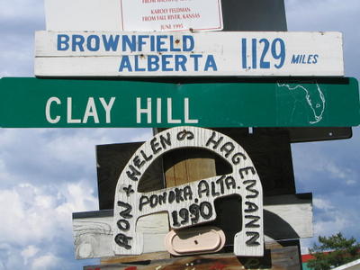 These folks certainly are ambitious. We didn't see them at their sign this year:
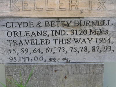
After poking around the town, and spending a total of $50 Canadian for rides back and forth, we settled down for a good night's rest. Once again, the gods smiled on us and we kept the tent and sleeping bags in the back of the airplane. The couches in the pilot's lounge did the job just fine, thank-you-very-much.
No comments:
Post a Comment