Final preparations have begun for the 2006 Cleveland National Airshow.
Seen so far today:
Arrival of Blue Angel #7.
Low Passes and arrival of two A-10 Thurderbolts a/k/a "Warthogs."
Departure and vertical takeoff of Blue Angel #7.
Arrival of big hacking four-engine Coast Guard propeller plane.
Should be plenty more tomorrow and Friday, including Blue Angel practice flights! If you're attending, I'll be there on Sunday with the Little IFR Pilot and volunteering at the Angel Flight station on Monday morning.
4:30 Update:
Arrival of a United 757. Looks very much out of place on the BKL ramp.
Practice by the Exxon Flyin' Tiger. Sweet aerobatics, that's for sure!!!
Wednesday, August 30, 2006
Tuesday, August 29, 2006
Breakfast Run; Mystery Solved
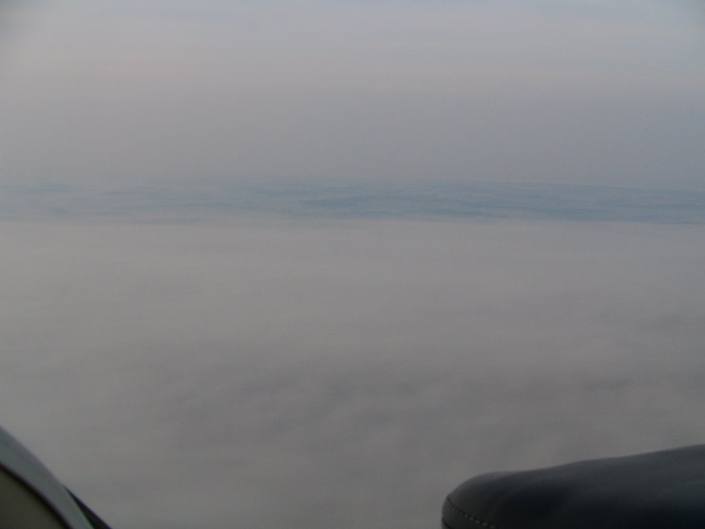
Saturday morning dawned rather moist in Northeast Ohio. Visibilities at ground level were awful, but the ceilings were reported around 8000.
Hey, sounds like a perfect day to go fly for some breakfast!
We meet at the hangar at 7:30. MS, for once, has prefiled an IFR flight plan. He takes leg #1. Destination: The Flying Turtle, to be found at the end of the ILS 32.
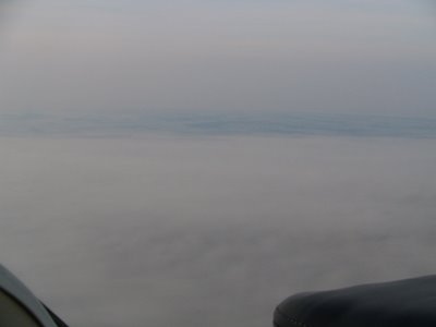
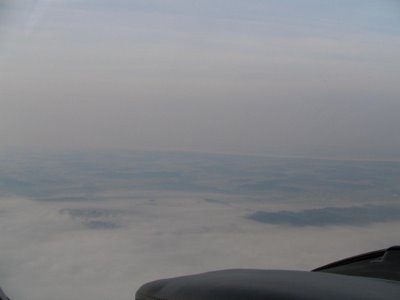
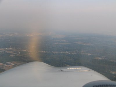
Visibilities are at 3 miles when we blast off. We are later told that we disappeared about 500' AGL, but for the record, we had plenty of visibility!
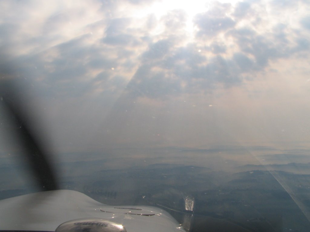
Here's some pictures of what things looked like shortly after takeoff:
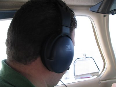
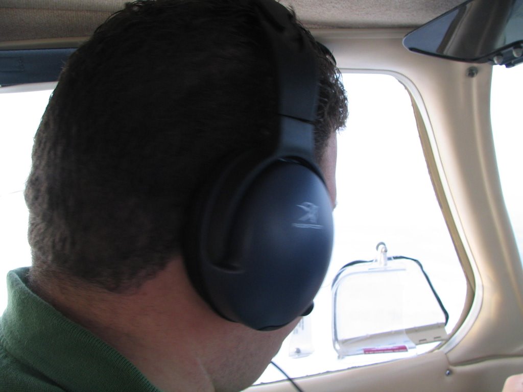
And here's the back of MS's head, just because.
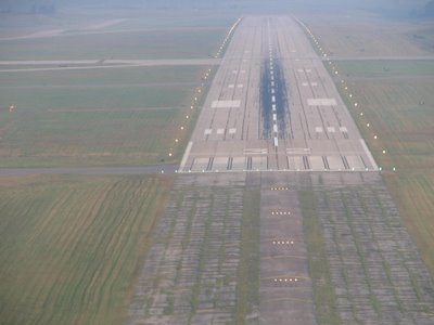
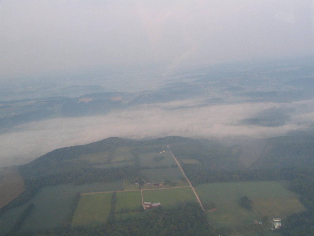
Akron Approach handed us off to Mansfield Approach and we were vectored for the ILS 32. Had the runway from way out:
 But they were still kind enough to switch the lights on for us. Kinda like Motel 6, huh?
On taxiing to the ramp, we were immediately concerned. There wasn't another airplane in sight. Was the Flying Turtle closed? We checked in with Tower, who said the Turtle opens at 8:00.
It's 8:10.
Where is everyone?
We trotted up to the door and had a quick conversation with a member of the staff. Seems that there was a gas leak in the restaurant and they were waiting for the gas company to arrive and figure out the problem. She wasn't even supposed to be inside, she just thought it might be a good idea to shut the coffee pot off....
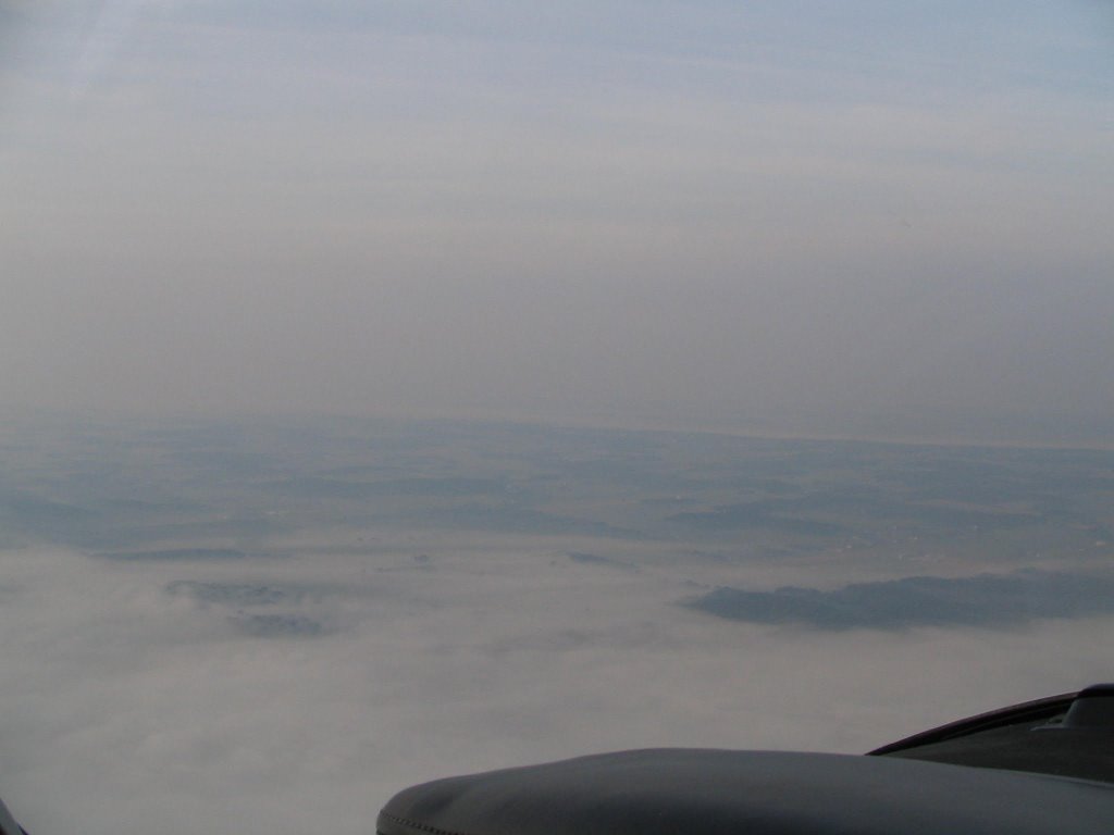
So, stomachs empty, we set off in search of new food choices. We decided to hightail it to Carrol County (KTSO). We'd skip the pie that early in the day -- this time -- but we should still be able to find something to knosh on.
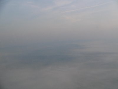
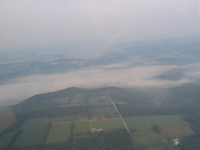
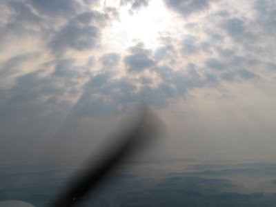
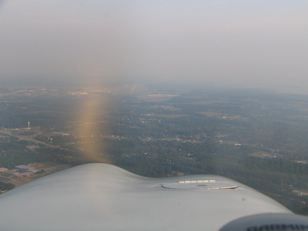
The ground fog/haze wasn't much better heading east:
 Eventually, we made it into Carrol County via the GPS 7. We had to dogfight a pair of ultralights for #1 position, but they backed down when we explained about the hardpoints underneath our wing.... OK, just kidding, they willingly surrendered with the comment "It'll take us a week to get to where you are."
Breakfast was ordered and we were cheerfully awaiting the arrival of our artery hardening delights when the hostess brought the phone to us.
"Didn't you just arrive in that Cherokee?"
"Yep."
"Akron Approach wants to talk to you."
Uh-oh.
Seems we forgot to cancel IFR before landing, even though we had a definite action plan to accomplish this using CRM. We also forgot to call and cancel via telephone, which was our other option.
But, alas, all was taken care of with a few quick apologies. But it made us wonder whether the controllers have a notebook full of phone numbers to call for just such eventualities. Anyone know?
On another note, during our flight, we were able to solve a mystery that had inspired MS to again attempt to spend more of the IFR Pilot's money by justifying changing the GPS to a GNS 430. During his recent flight home from Detroit, MS had been given a series of intersections to which he was supposed to fly, including JUNKR and SPHRE.
When he returned the next day, MS pronounced that he hadn't been able to locate either of them in the GPS. They were, however, prominently displayed on the MX-20. So he simply flew towards them using the MFD.
It turns out that both of these intersections are, in fact, in the GPS. You just have to know where to look.
Unlike the 430, the GX 50 categorizes intersections: E for eastern U.S., W for western U.S., and I for international fixes. So, in order to activate an en route intersection, you have to know to which of these categories the fix belongs.
MS assumed that both were E fixes. But, as it happens, they are both I fixes, as they are located out over the middle of Lake Erie.
Moral of the story: When the first two categories of fixes fail, try the third.
Whose idea was it to categorize the fixes anyway?
Hey, sounds like a perfect day to go fly for some breakfast!
We meet at the hangar at 7:30. MS, for once, has prefiled an IFR flight plan. He takes leg #1. Destination: The Flying Turtle, to be found at the end of the ILS 32.
Visibilities are at 3 miles when we blast off. We are later told that we disappeared about 500' AGL, but for the record, we had plenty of visibility!
Here's some pictures of what things looked like shortly after takeoff:

And here's the back of MS's head, just because.
Akron Approach handed us off to Mansfield Approach and we were vectored for the ILS 32. Had the runway from way out:
 But they were still kind enough to switch the lights on for us. Kinda like Motel 6, huh?
On taxiing to the ramp, we were immediately concerned. There wasn't another airplane in sight. Was the Flying Turtle closed? We checked in with Tower, who said the Turtle opens at 8:00.
It's 8:10.
Where is everyone?
We trotted up to the door and had a quick conversation with a member of the staff. Seems that there was a gas leak in the restaurant and they were waiting for the gas company to arrive and figure out the problem. She wasn't even supposed to be inside, she just thought it might be a good idea to shut the coffee pot off....
So, stomachs empty, we set off in search of new food choices. We decided to hightail it to Carrol County (KTSO). We'd skip the pie that early in the day -- this time -- but we should still be able to find something to knosh on.
The ground fog/haze wasn't much better heading east:

 Eventually, we made it into Carrol County via the GPS 7. We had to dogfight a pair of ultralights for #1 position, but they backed down when we explained about the hardpoints underneath our wing.... OK, just kidding, they willingly surrendered with the comment "It'll take us a week to get to where you are."
Breakfast was ordered and we were cheerfully awaiting the arrival of our artery hardening delights when the hostess brought the phone to us.
"Didn't you just arrive in that Cherokee?"
"Yep."
"Akron Approach wants to talk to you."
Uh-oh.
Seems we forgot to cancel IFR before landing, even though we had a definite action plan to accomplish this using CRM. We also forgot to call and cancel via telephone, which was our other option.
But, alas, all was taken care of with a few quick apologies. But it made us wonder whether the controllers have a notebook full of phone numbers to call for just such eventualities. Anyone know?
On another note, during our flight, we were able to solve a mystery that had inspired MS to again attempt to spend more of the IFR Pilot's money by justifying changing the GPS to a GNS 430. During his recent flight home from Detroit, MS had been given a series of intersections to which he was supposed to fly, including JUNKR and SPHRE.
When he returned the next day, MS pronounced that he hadn't been able to locate either of them in the GPS. They were, however, prominently displayed on the MX-20. So he simply flew towards them using the MFD.
It turns out that both of these intersections are, in fact, in the GPS. You just have to know where to look.
Unlike the 430, the GX 50 categorizes intersections: E for eastern U.S., W for western U.S., and I for international fixes. So, in order to activate an en route intersection, you have to know to which of these categories the fix belongs.
MS assumed that both were E fixes. But, as it happens, they are both I fixes, as they are located out over the middle of Lake Erie.
Moral of the story: When the first two categories of fixes fail, try the third.
Whose idea was it to categorize the fixes anyway?
Food for Thought
Sam recently inquired about one's favorite haunts for the $100 hamburger. Here's a few on this side of the country:
Flying Turtle at MFD. Typical airport cafe, but with huge glass windows facing the ramp. I never knew the airport had an FBO until recently, because we always used the Turtle for our "environmental needs" and fuel was never a concern.
Perfect Landing at PHD. No views of the runway if you are sitting inside the restauant, but you can catch a glimpse of the ramp if sitting at the bar. Also there's a nice patio outside when the weather cooperates. Don't be intimidated by the graveyard that you fly over on final approach!
Rick's Boatyard Cafe at EYE. Only visited the place once, on the flying school trip to tour the Cessna factories. But the food was excellent, the ambiance great, and it's just across the road from the airport. Did I mention it's on a lake?
Airport Cafe at TSO. Pretty much every local flight instructor will drag their students to this little hole in the wall. Not a lot of seating, the menu's somewhat limited, and the service can be lacking. Why go there at all then? One word: Pie. It's some of the best around.
Primo Barone's at FKL. All the Italian you can manage. Great views of the runways, live Jazz on Friday nights, even the locals haunt this place. Be sure to bring breath mints due to the illegal amounts of garlic that will be included in your dinner.
Someplace at the airport at Dawson Creek, British Columbia. Can't remember the name of this place, but it served a heck of a burger while the IFR Pilot and Dadster were waiting out some thunderstorms on the way home from Alaska.
Hornblower's at BKL. Basically, a restaurant located on a barge moored to the lake and abutting the airport. Great views from the topside deck, especially during the Cleveland National Airshow and the Thursday and Friday practice sessions.
JP's Barbeque Ribs and Chicken at TZR. This is a recent addition to the list of places to feed one's face. MS and The IFR Pilot went there a few weeks ago and had to recompute the W&B on Mike Hotel before we went home. I skipped most of my meals the next day to make up for the hedonism that was displayed the night before.
Oh, yeah, don't forget about the free brats and dogs on Saturdays at Sporty's!
That about does it, but if you know some more in the Upper Eastern Midwest (i.e., Ohio, Western Pennsylvania, Eastern Indiana), send 'em my way. We can always use a new distraction.
Friday, August 25, 2006
Fish Out of Water
The phone rang. Looking at the caller ID, I see it's MS. It's probably our fourth telephone conversation of the day, and who knows how many harassing e-mails have already been exchanged.
IFRP: "What?"
MS: "What are you doing tomorrow?"
IFRP: "Working. Like I do every Friday."
MS: "Marissa called from Angel Flight East. They need a pilot. I may not be able to go, I told her to call you. Take the mission, and if I can join you, I will."
IFRP: "Fine. I've worked hard enough this week, I'll do a good deed."
MS: "About time you did something good."
IFRP: "Eff off. I hate you."
MS: "The feeling's mutual."
Naturally, as these things go, MS had to slave away at the office and the IFR Pilot had no co-pilot.
The mission itself was straightforward. Pick up the passengers at Burke Lakefront, bring them to Tri-Cities Regional in Bristol/Johnson City/Kingsport, Tennessee. There, we'd meet up with the linking pilot, who would bring the passengers to their final destination, somewhere in Georgia.
Landing at Burke was no problem, as the IFR Pilot did his private pilot training there. But they are prepping for the Cleveland National Air Show this coming weekend, so there are runway and taxiway closures galore. The ground controller and I did battle, but we finally got on the same page, and takeoff ensued.
No matter your destination, IFR departures from Burke inevitably receive the following instruction: "Turn [left or right] heading 350 and contact departure."
Today's instruction: "Turn left heading 350 and contact departure."
No problem, except that this is just about exactly the opposite heading from the one we need to get to KTRI. And it takes us out over Lake Erie. Which I don't mind for a few minutes, but I really don't want to dilly-dally over the lake.
So, I'm obliged to pester ATC and request a turn on course. They quickly grant my request, and we make a 180-degree turn to our en-route heading. Within minutes, the passengers are fast asleep and the IFR Pilot is left to ponder life for the three-hour tour.
Approaching Bristol, it occurs to me that I've heard of this town before. You might have as well. You know, Bristol Motor Speedway. Hmmmm, wonder if they are having a race there this weekend.... The FSS briefer didn't say anything about any special NOTAMS. They didn't ask me if I had a STMP slot reservation. The race must be another weekend.
Wrong. Way wrong. Completely wrong.
This is, in fact, Bristol Race Weekend.
There must have been five flights inbound on the ILS 23, due to the 3 mile visibility. The IFR Pilot wondered if he might draw his first actual hold. Not that he wanted one, mind you, as it's always been a somewhat weak point. (Add it to the list of things to work on during the next dual instruction session.)
Instead, we got a delay vector that brought us abeam with the airport and then a 180-degree turn and then vectors back to the localizer. (NB: Remember to adjust the nav source switch on the autopilot when changing from following the GPS to the #1 NAV.) You can see it here on the track from Flight Aware -- note the big "S" on the flight path near KTRI:

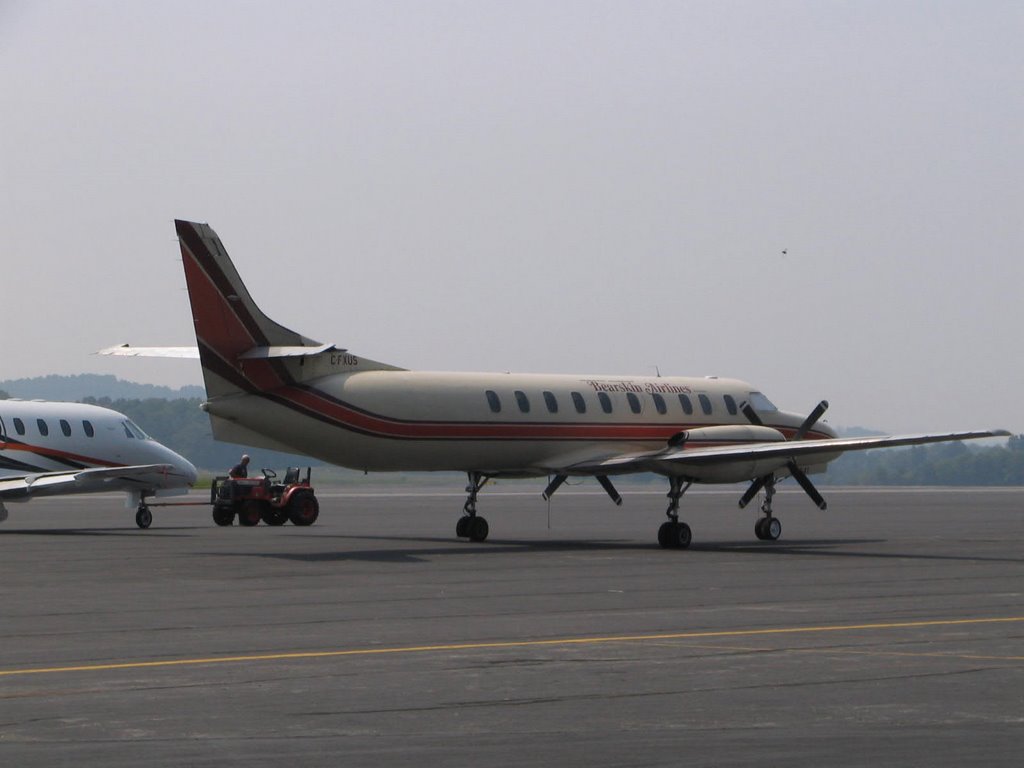
We followed in "Bearskin 123," which I thought might be a military traffic, but turned out to be a charter from Northern Ontario in for the race.
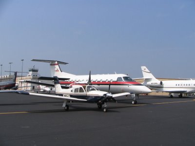
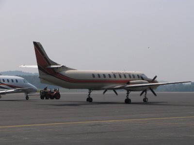 The ramp was jam-packed with executive aircraft of all shapes and sizes, including Citations, Lear Jets, King Airs, race helicopters, and others.
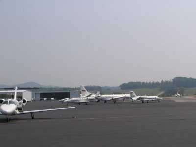 Mike Hotel and his av-gas burning piston engine seemed very much out of place parked on the ramp today next to all of the Jet A burnders -- a bit like a fish out of water. See for yourself:
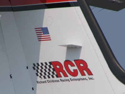
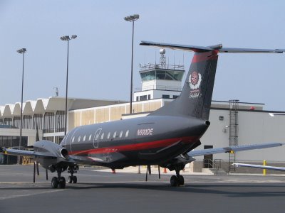
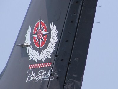
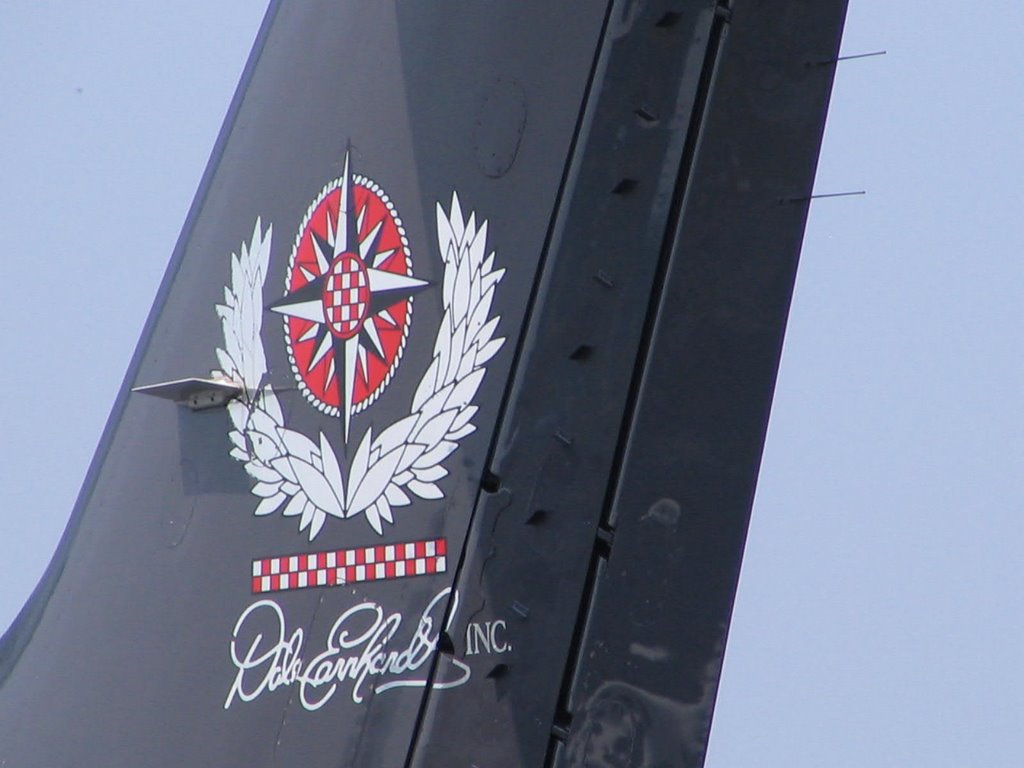
 I took the opportunity to snap some pictures of the various aircraft favored by the "other half." Some of which bore markings of their owners/operators.
The flight home was uneventful. Took only 2 hours, thanks to the favorable tailwinds and the fact that the Home Base is 35 miles south of Burke, making the trip home just a little shorter.
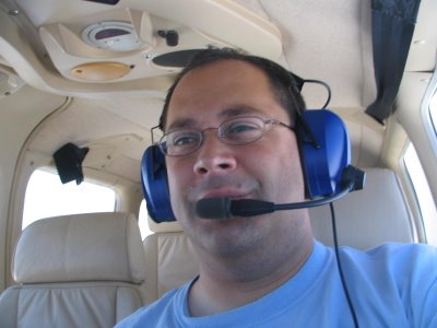
And that's how the IFR Pilot spent Friday, playing hookey from work. Obligatory closing photo of the IFR Pilot doing his thang!
IFRP: "What?"
MS: "What are you doing tomorrow?"
IFRP: "Working. Like I do every Friday."
MS: "Marissa called from Angel Flight East. They need a pilot. I may not be able to go, I told her to call you. Take the mission, and if I can join you, I will."
IFRP: "Fine. I've worked hard enough this week, I'll do a good deed."
MS: "About time you did something good."
IFRP: "Eff off. I hate you."
MS: "The feeling's mutual."
Naturally, as these things go, MS had to slave away at the office and the IFR Pilot had no co-pilot.
The mission itself was straightforward. Pick up the passengers at Burke Lakefront, bring them to Tri-Cities Regional in Bristol/Johnson City/Kingsport, Tennessee. There, we'd meet up with the linking pilot, who would bring the passengers to their final destination, somewhere in Georgia.
Landing at Burke was no problem, as the IFR Pilot did his private pilot training there. But they are prepping for the Cleveland National Air Show this coming weekend, so there are runway and taxiway closures galore. The ground controller and I did battle, but we finally got on the same page, and takeoff ensued.
No matter your destination, IFR departures from Burke inevitably receive the following instruction: "Turn [left or right] heading 350 and contact departure."
Today's instruction: "Turn left heading 350 and contact departure."
No problem, except that this is just about exactly the opposite heading from the one we need to get to KTRI. And it takes us out over Lake Erie. Which I don't mind for a few minutes, but I really don't want to dilly-dally over the lake.
So, I'm obliged to pester ATC and request a turn on course. They quickly grant my request, and we make a 180-degree turn to our en-route heading. Within minutes, the passengers are fast asleep and the IFR Pilot is left to ponder life for the three-hour tour.
Approaching Bristol, it occurs to me that I've heard of this town before. You might have as well. You know, Bristol Motor Speedway. Hmmmm, wonder if they are having a race there this weekend.... The FSS briefer didn't say anything about any special NOTAMS. They didn't ask me if I had a STMP slot reservation. The race must be another weekend.
Wrong. Way wrong. Completely wrong.
This is, in fact, Bristol Race Weekend.
There must have been five flights inbound on the ILS 23, due to the 3 mile visibility. The IFR Pilot wondered if he might draw his first actual hold. Not that he wanted one, mind you, as it's always been a somewhat weak point. (Add it to the list of things to work on during the next dual instruction session.)
Instead, we got a delay vector that brought us abeam with the airport and then a 180-degree turn and then vectors back to the localizer. (NB: Remember to adjust the nav source switch on the autopilot when changing from following the GPS to the #1 NAV.) You can see it here on the track from Flight Aware -- note the big "S" on the flight path near KTRI:

We followed in "Bearskin 123," which I thought might be a military traffic, but turned out to be a charter from Northern Ontario in for the race.
 The ramp was jam-packed with executive aircraft of all shapes and sizes, including Citations, Lear Jets, King Airs, race helicopters, and others.
 Mike Hotel and his av-gas burning piston engine seemed very much out of place parked on the ramp today next to all of the Jet A burnders -- a bit like a fish out of water. See for yourself:
 I took the opportunity to snap some pictures of the various aircraft favored by the "other half." Some of which bore markings of their owners/operators.

The flight home was uneventful. Took only 2 hours, thanks to the favorable tailwinds and the fact that the Home Base is 35 miles south of Burke, making the trip home just a little shorter.
And that's how the IFR Pilot spent Friday, playing hookey from work. Obligatory closing photo of the IFR Pilot doing his thang!

Thursday, August 24, 2006
On The Law Of Charts
In a recent post, a query was posed regarding the requirement to have paper charts when the PIC has available up-to-date electronic navigation information via GPS and MFD.
The IFR Pilot and The Aviation Mentor (f/k/a The Freight Dog) exchanged a few e-mails on the issue.
In a slack moment this afternoon, The IFR Pilot drew on his years of legal education and training to see if he could find any NTSB decisions on point. There really weren't any that held that MFD charts substitute for paper. But, one decision raises speculation on the notion that paper charts are required to satisfy FAR 91.103's requirement that the PIC become familiar with "all available information" about the route of flight.
I quote from Administrator v. Smith, 1992 NTSB LEXIS 86, as follows:
Anyone read this differently? Because if my interpretation is correct, so long as I am familiar with "all available information," then it's not a violation of FAR 91.103 if I go fly and forget my charts in the hangar. (Or if I never buy them.) Perhaps I'm familiar from my past flight experience in the area. Perhaps I'm familiar because I am reviewing the chart on my MX 20. Either way, I think I've got a defense.
The IFR Pilot and The Aviation Mentor (f/k/a The Freight Dog) exchanged a few e-mails on the issue.
In a slack moment this afternoon, The IFR Pilot drew on his years of legal education and training to see if he could find any NTSB decisions on point. There really weren't any that held that MFD charts substitute for paper. But, one decision raises speculation on the notion that paper charts are required to satisfy FAR 91.103's requirement that the PIC become familiar with "all available information" about the route of flight.
I quote from Administrator v. Smith, 1992 NTSB LEXIS 86, as follows:
The Administrator cites two cases for the proposition that§ 91.5 requires not just familiarity with available information but that necessary charts be in the aircraft. Although we need not reach this issue, we note that the first case, Administrator v. Holter, 5 NTSB 826 (1985), contains language that could be read to support the Administrator's position. This meaning was not intended. In that case, respondent was also charged with violating § 91.183 (now 91.503), which requires navigational charts in the aircraft, and the discussion encompassed both claims. The second case, Administrator v. Hillman, 5 NTSB 803 (1985), which, like Holter, involved a 91.183 claim as well, does not anywhere suggest that § 91.5 requires maps in the cockpit. Although not having them could certainly lead to a § 91.5 violation, we are unaware of Board precedent adopting the interpretation advanced here, nor is such an interpretation obvious from the language of § 91.5.Now, I'm just a poor, somewhat humble lawyer trying to make a living in this cold, cruel world. But I sure interpret this to be a repudiation of the notion that lack of paper charts constitutes a per se violation of FAR 91.103. (Note that the provisions of current FAR 91.103 formerly were found in FAR 91.5).
Anyone read this differently? Because if my interpretation is correct, so long as I am familiar with "all available information," then it's not a violation of FAR 91.103 if I go fly and forget my charts in the hangar. (Or if I never buy them.) Perhaps I'm familiar from my past flight experience in the area. Perhaps I'm familiar because I am reviewing the chart on my MX 20. Either way, I think I've got a defense.
Monday, August 21, 2006
JS, Photographer Extraordinaire
(Yes, this is the fifth post in a 48-hour peroid. Be sure that you've scrolled down and read them all. You don't want to miss anything, do you???)
Recently, MS was out for a flight. It was, in fact, his first flight with ZS, a/k/a "Little MS," who, truth be told, is a lovely little kid, notwithstanding the individual who fathered him.... :-)
Anyhooo, some stars were in alignment that night and JS happended to be at the airport. He was kind enough to put his digital camera to use and came up with these pictures of ZS's first flight. On behalf of MS, Mrs. MS, and ZS, thanks JS (no relation to the other S's!).


Sunday, August 20, 2006
2004 Summer Vacation -- Day 1
It seemed like such a simple plan. Fly from my home in Cleveland to see my family in Connecticut. Pick up Dad, and spend a few quality days exploring New England by air, camping under the wing and enjoying the kind of freedom that only general aviation can afford. It sounded perfect, but I was about to discover that Mother Nature had her own plans for my week's vacation.

GA pilots learn early on in their student pilot days - perhaps when a lesson is cancelled due to an unfavorably strong crosswind - how fickle the weather can be, and how important it is to keep your travel plans flexible. With light aircraft, it's difficult to set an agenda and stick to it regardless of what develops. Pilots who fail to heed that simple lesson can often be read about in the pages of NTSB accident reports.
With that sober thought in mind, I set off on my flying vacation.
Day 1
Cleveland, OH to Westerly, RI, 451nm
My original plan was to depart my home airport around 10am and arrive in Rhode Island around 2pm. But, the evening before departure, a check of the weather shows a cold front threatening to push its way through our neck of the woods. Late morning thunderstorms look likely to make travel in my non-Stormscope equipped 1964 Cessna 172E all but impossible. So, I set the alarm clock for 5am. I'm going to beat that weather system out of Cleveland.
I'm up at five o'clock and on the phone to Flight Service for a briefing. My plan is to get to the airport early so I can take some time in the pilot's lounge to scan the radar and satellite images. Plus I want to run my flight plan through the AOPA Flight Planner to see how much help I'm going to get from those winds aloft. Sure, I could do it by hand, but it's easier and more precise to let the computer do it for me.
As I pull into the empty parking lot at Weltzien Skypark it occurs to me I never did find out that code on the airport office's digital combination lock. So much for relaxing in the pilot's lounge with a cup of coffee as I pore over the charts.
But as luck would have it, I've conned the IT guys at my office into loaning me a cellular modem card for my laptop. Now's the perfect chance to use it. And it works like a charm. I sit in my hangar, fire up the laptop, review the weather charts, and file an electronic flight plan. Looks like I'll get quite a push from those upper winds: 3.5 hours estimated time en route. Not too shabby for a 40-year old Skyhawk.
After fueling the main and auxiliary tanks, I call the local FSS to get my clearance. Only, they don't have a flight plan for me. Seems like every time I use DUATS to file a flight plan, it doesn't go through. One of these days, I'll figure out what I'm doing wrong. So, I sit on the phone for a few minutes while the briefer gets a clearance for me. Our airport is on the border of the Cleveland and Akron terminal airspaces, so negotiating a clearance sometimes seems like an art form and always depends on which direction you depart.
Eventually, I get the following clearance: "N3978S is cleared to the Westerly State Airport via radar vectors, enter controlled airspace on a heading of 360, maintain 2000, expect 5000 ten minutes after departure . . . ." Well, how do you do, a clearance of over 400 miles via radar vectors? I expect I'll get an amendment to my clearance sooner or later.
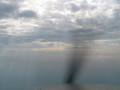
I launch into blue skies, get radar identified and indeed am then cleared onto my course as filed, to Westerly. All goes well, especially when just inside the Pennsylvania border, I experience my first actual IFR conditions while solo. I've had my IFR ticket for a month or so, with a couple of hours of actual instrument conditions during training. But this is the real thing, and I'm all alone in the thick. Thankfully, I've been exceptionally well trained by my CFII and all goes well. Mostly, I'm in and out of the cloud tops for about 45 minutes, but it's great experience and a huge confidence booster for things to come.
Nearing the Wilkes-Barre/Scranton area, ATC starts rattling off amended clearances that route me north of the New York Class Bravo airspace. It's a crash lesson in using the flight plan function of the Garmin 430 installed in 78S last February. A couple of Victor airways that have substantial course changes in them have me bemoaning the fact that I don't have an autopilot - or at least a third arm, what with maintaining straight and level, folding charts, and trying to input waypoints into the GPS.
Then, I get cleared direct to the THUMB intersection. I can't find it for the life of me, and, wanting to make sure that it doesn't have some kind of crazy spelling, I ask the controller to spell it for me. I'm surprised when he doesn't come back with, "Look at your hand and think about it!"
Eventually, I'm cleared for the localizer approach into runway 7 at Westerly. I spot the runway from a couple miles out, cancel IFR, and circle to land on Runway 25. Dad's there waiting for me, and I've made the trip in a mere 3.5 hours. Hmmm, I wonder what kind of headwinds I'll get for the trip home.

Resurrection of the 2004 Summer Vacation Report
In the summer of 2004, when the IFR Pilot and Dadster were originally scheduled to visit Alaska, some life events required a change of plans. So the IFR Pilot and Dadster did an aerial vacation in New England. The IFR Pilot wrote a comprehensive series of reports on the trip for an article that appeared on FlyGuides.com.
Recently, the IFR Pilot learned that FlyGuides.com is no longer being maintained. :-( It was a good source for travel hints and suggestions when planning your next getaway. It's a niche on the Internet that is surprising someone else hasn't moved to fill. (MS, I see you next great entrepreneurial adventure here....)
Anyway, it's sad that the site is gone, because that was the only record that I had of those flights. So, I'm doing a bit of digging in Google's cache and am attempting to resurrect some of the stories, albeit text only. I'll be posting them here as I'm able to recover them.
Query
Let's say your aircraft is equipped with a terminal, en route, and approach certified GPS and a MFD that displays both VFR and IFR charts (although not approach plates). You subscribe to an update service that updates both with new navigational data every 28 days, and you religiously perform those updates.
Question 1: Are you legal to fly without having any paper charts on board? (Set aside the wisdom of such, given that the GPS and/or MFD could always fail. Just from a technical legal point of view -- are you in compliance with the Federal Aviation Regulations.)
Question 2: Suppose that you do have paper charts on board, but they are not current. If paper charts are required, would out-of-date charts, supplemented by a current set of electronic charts on your GPS/MFD, satisfy the regulations?
Saturday, August 19, 2006
Accident of the Week
This week's Accident of the Week (tm), brought to you slightly belated, actually involves two accidents. Although the apparent causes are completely different, they involve a common thread. Read them first and see if you agree with the IFR Pilot's subsequent analysis.
Accident #1
14 CFR Part 91: General Aviation
Accident occurred Thursday, August 10, 2006 in Tucson, AZ
Aircraft: Robinson R22 Beta, registration: N7059S
Injuries: 1 Fatal, 1 Serious.
This is preliminary information, subject to change, and may contain errors. Any errors in this report will be corrected when the final report has been completed.
On August 10, 2006, about 0930 mountain standard time, a Robinson R22 Beta, N7059S, descended into high mountainous terrain about 19 miles north of Tucson, Arizona. The helicopter was operated by Air Photo, Inc., Everett, Washington, during the aerial photography flight, and it was destroyed. The commercial pilot was seriously injured, and the passenger (photographer) was fatally injured. Visual meteorological conditions prevailed at the time, and no flight plan had been filed. The flight was performed under the provisions of 14 CFR Part 91, and it originated from Tucson about 0820.
The pilot reported to the National Transportation Safety Board investigator that after takeoff from the Tucson International Airport, elevation 2,643 feet mean sea level (msl), he proceeded on his aerial photography assignment. Federal Aviation Administration (FAA) radar flight following service was terminated about 0843. Thereafter, the pilot proceeded up a shallow valley-like area.
The pilot was initially cruising about 300 feet over ridgelines at 60 knots indicated airspeed, and was flying over rising mountainous terrain in a northerly direction. According to the pilot, he was proceeding toward the general area specified by the company photographer. The underlying terrain did not look like a gorge or deep valley, and in areas it appeared somewhat flat.
Regarding the meteorological conditions in the general area, the pilot reported observing a developing thunderstorm between 10 and 15 miles northeast of his location. The sky was clear along his flight route.
The pilot further stated that after he encountered a 1,000-foot-per-minute rate of climb (updraft), he performed a 180-degree course reversal left turn (toward lower elevation terrain) to exit the area. After completing the turn the low rotor speed warning horn sounded. Then, the helicopter encountered a downdraft, and it began descending. The pilot reported that he was not able to arrest the descent, and the helicopter impacted the terrain. The pilot stated that he recalled the outside air temperature gauge indicated it was 21 degrees Celsius. The pilot reported to the FAA coordinator that during the accident flight he had not experienced any mechanical malfunction with the helicopter.
The helicopter came to rest in a ravine, located in the Pusch Ridge Wilderness area of the Coronado National Forest. The estimated elevation of the accident site is 6,300 feet msl. The site is located about 32 degrees 23.500 minutes north latitude by 110 degrees 46.082 minutes west longitude.
Accident #2
NTSB Identification: LAX06FA258
Nonscheduled 14 CFR Part 135: Air Taxi & Commuter
Accident occurred Friday, August 11, 2006 in Saipan, Northern Mariana Islands
Aircraft: Piper PA-32-300, registration: N4509T
Injuries: 5 Serious, 2 Minor.
This is preliminary information, subject to change, and may contain errors. Any errors in this report will be corrected when the final report has been completed.
On August 11, 2006, about 0215 Saipan standard time (August 10, 2006 at 1615 UTC), a Piper PA-32-300, N4509T, experienced a loss of engine power during initial climb from the Saipan International Airport, Saipan, Northern Mariana Islands (NM). The pilot made a forced landing in a high vegetation area about 1/4-mile southeast of the departure end of runway 07. The airplane was destroyed during the hard landing and post impact ground fire. The single engine "Cherokee Six" airplane had a total of seven installed seats. The commercial pilot and four passengers received serious injuries. Two passengers received minor injuries. The airplane was operated by its owner, Taga Air Charter Services, Inc., Tinian, NM, under a passenger transportation contract on behalf of the Tinian Dynasty Hotel & Casino, which employed the pilot. According to Federal Aviation Administration (FAA) personnel, it was their understanding that the purpose of the on demand passenger-carrying flight was to transport five passengers and the operator's off duty company pilot to the neighboring island of Tinian, about 11 nautical miles away. The flight should have been performed under the provisions of 14 CFR Part 135. Visual meteorological conditions prevailed during the dark nighttime flight, and the flight was dispatched under a company visual flight rules flight plan. The flight originated about 0213.
Saipan air traffic control tower personnel reported to the National Transportation Safety Board investigator that seconds after the pilot became airborne, he broadcast "09T going down." No further communications were received by the control tower.
Parties assisting the Safety Board investigator reported that their physical examination of the airplane's structure and ground scar were consistent with the airplane impacting the terrain in a near level flight attitude. The airplane was found oriented on an approximate magnetic heading of 077 degrees. The site elevation was about 220 feet mean sea level. The global positioning satellite (GPS) coordinates of the accident site are 15 degrees 07.245 minutes north latitude by 145 degrees 44.842 minutes east longitude.
Taga Air's Director of Operations (DO) reported to the Safety Board investigator that the company only fuels the main (inboard) fuel tanks, and the outboard (tip) tanks are typically empty or nearly empty. The Safety Board parties reported observing that all of the fuel tanks had been breached. Several gallons of fuel were found in the left main fuel tank. The entire fuselage and empennage were consumed by fire.
Can you spot the connection? While the NTSB will have the final word, we can speculate a bit. Accident #1 may have been caused by the pilot's decision to continue flight in the vicinity of a thunderstorm. Accident #2 may have been caused by the pilot's decision to operate the aircraft in an over-maximium gross weight condition (depending on the total weight of the seven passengers).
How about this: Both pilots may have had their authority as Pilot In Command eroded by the pressures of their employers to "get the job done." We all know and understand that the profit margins in aviation are reed-thin. Passing up a paying aerial photography charter, or taking one less gambler to the casino, translates into a loss of real dollars to the companies operating these aircraft.
Although many of us may fly solely for pleasure, and therefore need not concern ourselves with this particular dynamic, the dreaded disease "get-there-itis" has similar qualities. We choose to push the envelope -- say, by flying a bit closer to the thunderstorm -- because we did so in the past and lived to talk about it. Obviously, the yardstick of "did it before, it'll be alright to do it again" should be the last standard we use to measure our aviation choices.
Some have accused the IFR Pilot of being overly conservative, unwilling to fly in adverse conditions, etc. I suppose there's some truth to that. But, I'd rather be here, writing about other people's accidents, than vice-versa. Normally, when it comes time to make a difficult choice, I apply a decision-making rubric that I read in a magzine article once: How would the NTSB accident report describe your actions as PIC? Seems to me the FAA should add this concept to its required knowledge in the area of aeronautical decision-making.
Thursday, August 17, 2006
Pouty, Pouty IFR Pilot
The IFR Pilot is pouting today. And nothing's gonna change his mood.
Why, you ask? (Thank you for asking...)
Because as he leans back in his desk chair and admires the view of BKL, sitting out there is a lovely little 1979 Piper Arrow IV, N72MH.
Yes, indeed, that Mike Hotel.
And the IFR Pilot didn't fly him up here.
Seems that MS has some important "committment" in Hockeytown tonight, so he commuted to work via air and then parked Mike Hotel on the ramp.
Right where the IFR Pilot has to ogle the plane all freakin' day.
And MS won't play hooky, with the only key to the plane, and go flying during the lunch hour.
On the upside, MS was able to use the electric winch in the hangar this morning without killing himself or inflicting substantial damage on Mike Hotel. That qualifies as a good day.
And now, the IFR Pilot is going back to pouting.
Monday, August 14, 2006
Boatloads of Cussing. No Flying Involved...
When we acquired Mike Hotel, MS and the IFR Pilot still hadn't disposed of their interest in 78S. Since we couldn't park Mike Hotel in the old hangar, we had to find a new home for him. We lucked out, found a nice hangar on the field, near the middle of the lone runway. It's at the end of the row, which means it's T-shaped on only one end. Gives us a bit of extra room in the back corner. There's a nice long apron, which gives us a great place to set up the BBQ and lawn chairs and grade the performance of other pilots.
Now, the old hangar was "new." It had only been built a few years previously. The original owner, who perished in the SwissAir 111 accident a few years ago, had epoxied the floor and otherwise done some improvements on the structure. (JS was kind enough to use his construction skills to finish the ceiling insulation.)
On the other hand, the new hangar is "old." Not as old as some of the hangars on the field, but certainly not of recent vintage. It's not entirely airtight, as evidenced by the substantial amount of grass clippings that invade the hangar when the grass gets mowed. There's bare sheathing and framing visible on most of the walls, and there's no ceiling at all. We have a wonderful view of the rafters. (Perhaps we should add a skylight....)
But there's one really, really big difference. The old hangar had a wonderful Schewiss bi-fold electric door. You'd arrive, undo the two locking handles, push a button, and the machines did the rest of the work. Pull 78S out, hit another button, and everything closed up. The only real trick was remembering to lock the access door before raising the hangar door -- otherwise the door would come swinging down as the hangar door was raised.
The new hangar has no such fancy gizmos. It has two generic garage doors, and a mechanical crank is used to raise the center post out of the way, once the doors have been raised. Depending on who's counting, it's either 64 or 68 turns of the handle to move the post. When you consider that you have to do this four times for each flight (unless you're being lazy and leave the doors open while your punching holes in the clouds), that's a whole lotta handle turning.
We'd been discussing swapping the manual crank out for a winch for some time, more aggressively since we learned that we were going to be purchasing the hangar. (Ownership = equity = good; leasing = rent = wasting money.) MS called Friday after turning the crank 240+ times in his wool dress suit and fancy tie to announce that we were proceeding with the Great Winch Upgrade Project (tm), 2:00 on Sunday.
So, after spending close to $200 dollars for the winch, new steel cable and accessories, and -- of course -- the necessary tools (anyone want a wire cutter that's only been used twice? or a ferrule crimper that's only crimped two ferrules?), we got the electric winch installed.
Highlights from the project:
1. MS smashing his finger while using a piece of 2 x 4 as a hammer.
2. MS smashing his finger again, because he never learns his lessons the first time.
3. The IFR Pilot stepping into some used aviation oil that was being used to lubricate the drill bit. Then gingerly moving around the hangar, trying to clean his new Nike Air Waubesa sandal, with unshoed foot on which he had just the day before smashed the little toe, which now looks like a purple magic marker.
4. MS, frustrated beyond belief during the drive to Home Depot for more supplies, "No one should be allowed to drive on roads but me! This is why I have no use for humanity." My co-owner truly has a sunny disposition.
5. MS's repeated use of the word "fulcrum."
6. Concrete anchors sometimes don't. This can make it very difficult to tighten the nuts that are going to secure your winch to the floor.
7. A metal cookie tin does not keep honey roasted peanuts airtight. Less than airtight peanuts have the consistency of bad gum. Really, really bad gum.
8. When you think that you are 90% done with a simple littlehome hangar improvement project, it will only take another 2+ hours to finish.
9. It's a sign of lacking confidence in your work when neither of you will stand anywhere near the center post as it is electrically winched up.
10. All of the foregoing will inspire strings of cusswords that would make even the most seasoned Bosun's Mate blush.
Here's to you, MS. You perserved in the face of incredible obstacles just so that you never have to sweat in your dress shirt and wool suit again!
Now, the old hangar was "new." It had only been built a few years previously. The original owner, who perished in the SwissAir 111 accident a few years ago, had epoxied the floor and otherwise done some improvements on the structure. (JS was kind enough to use his construction skills to finish the ceiling insulation.)
On the other hand, the new hangar is "old." Not as old as some of the hangars on the field, but certainly not of recent vintage. It's not entirely airtight, as evidenced by the substantial amount of grass clippings that invade the hangar when the grass gets mowed. There's bare sheathing and framing visible on most of the walls, and there's no ceiling at all. We have a wonderful view of the rafters. (Perhaps we should add a skylight....)
But there's one really, really big difference. The old hangar had a wonderful Schewiss bi-fold electric door. You'd arrive, undo the two locking handles, push a button, and the machines did the rest of the work. Pull 78S out, hit another button, and everything closed up. The only real trick was remembering to lock the access door before raising the hangar door -- otherwise the door would come swinging down as the hangar door was raised.
The new hangar has no such fancy gizmos. It has two generic garage doors, and a mechanical crank is used to raise the center post out of the way, once the doors have been raised. Depending on who's counting, it's either 64 or 68 turns of the handle to move the post. When you consider that you have to do this four times for each flight (unless you're being lazy and leave the doors open while your punching holes in the clouds), that's a whole lotta handle turning.
We'd been discussing swapping the manual crank out for a winch for some time, more aggressively since we learned that we were going to be purchasing the hangar. (Ownership = equity = good; leasing = rent = wasting money.) MS called Friday after turning the crank 240+ times in his wool dress suit and fancy tie to announce that we were proceeding with the Great Winch Upgrade Project (tm), 2:00 on Sunday.
So, after spending close to $200 dollars for the winch, new steel cable and accessories, and -- of course -- the necessary tools (anyone want a wire cutter that's only been used twice? or a ferrule crimper that's only crimped two ferrules?), we got the electric winch installed.
Highlights from the project:
1. MS smashing his finger while using a piece of 2 x 4 as a hammer.
2. MS smashing his finger again, because he never learns his lessons the first time.
3. The IFR Pilot stepping into some used aviation oil that was being used to lubricate the drill bit. Then gingerly moving around the hangar, trying to clean his new Nike Air Waubesa sandal, with unshoed foot on which he had just the day before smashed the little toe, which now looks like a purple magic marker.
4. MS, frustrated beyond belief during the drive to Home Depot for more supplies, "No one should be allowed to drive on roads but me! This is why I have no use for humanity." My co-owner truly has a sunny disposition.
5. MS's repeated use of the word "fulcrum."
6. Concrete anchors sometimes don't. This can make it very difficult to tighten the nuts that are going to secure your winch to the floor.
7. A metal cookie tin does not keep honey roasted peanuts airtight. Less than airtight peanuts have the consistency of bad gum. Really, really bad gum.
8. When you think that you are 90% done with a simple little
9. It's a sign of lacking confidence in your work when neither of you will stand anywhere near the center post as it is electrically winched up.
10. All of the foregoing will inspire strings of cusswords that would make even the most seasoned Bosun's Mate blush.
Here's to you, MS. You perserved in the face of incredible obstacles just so that you never have to sweat in your dress shirt and wool suit again!
Friday, August 11, 2006
Accident of the Week
This week's Accident of the Week (tm) involves a T-Tail Arrow, not unlike our beloved Mike Hotel, that disappeared earlier this year during a night flight over Lake Erie. The aircraft had just completed four laps over Niagara Falls -- something the IFR Pilot has done on numerous occasions -- when it disappeared from radar coverage.
The report indicates that the pilot-in-command held a commerical certificate. Although it is possible to hold a commercial certificate without an instrument rating, it's certainly the exception to the rule. So, for the sake of argument, let's assume that the PIC was instrument rated. And that makes the accident even more disturbing. One of the biggest criticisims of JFK, Jr.'s final flight was his decision to proceed at night, over water, without an instrument rating. This accident shows you that its possible for even an instrument rated pilot to lose control of the aircraft.
More information about the search for the wreckage here.
While the NTSB has yet to issue a probable cause determination, it doesn't seem too far fetched to suspect that the likely determination will be spatial disorientation, with a contributing factor being the conditions of flight (at night, over water). In fact, there are aspects of the crash that are reminiscent of JFK, Jr.'s accident.
The report indicates that the pilot-in-command held a commerical certificate. Although it is possible to hold a commercial certificate without an instrument rating, it's certainly the exception to the rule. So, for the sake of argument, let's assume that the PIC was instrument rated. And that makes the accident even more disturbing. One of the biggest criticisims of JFK, Jr.'s final flight was his decision to proceed at night, over water, without an instrument rating. This accident shows you that its possible for even an instrument rated pilot to lose control of the aircraft.
More information about the search for the wreckage here.
Thursday, August 10, 2006
A Conundrum
As pilots, one requirement of the Federal Aviation Regulations is to provide a pre-flight briefing to all passengers on specified items. The IFR Pilot's got a standard mantra that he runs through: how to operate the cabin door and seat belts (including the shoulder restraints), please don't grab the yoke or press the rudder pedals, and how to listen up on the headphones for when it's time to be quiet so I can talk to ATC. The usual rigamarole.
Sunday's Angel Flight presents a bit of conundrum for compliance with this requirement. According to the Mission Set-Up form, the passenger is deaf.
Well, that by itself wouldn't be a problem. I'd just gin up a briefing card that I would have her read and then acknowledge she understands by giving me a nod or thumbs up or something.
However, the Mission Set-Up form also indicates that she is "going blind." Now, I don't know exactly what that means. But let's assume for the sake of completeness that she's more than legally blind and would not be able to review a pre-flight briefing card.
How does one then comply with the requirements of FAR 91.107(a)?
_______________________
Update: Angel Flight called - mission canceled. But still an interesting question to ponder...
Tuesday, August 08, 2006
Dead Synapses
The plan was deceptively simple: ILS 32 at KMFD, GPS-A at 3G4, and GPS 10 at BJJ. Weather was a factor, due to the narrow gap between temperature and dew point -- 24 and 22, respectively. Predictably, with that 2 degree gap, there was some haze emerging. Also, there was a high overcast, nearly blocking out the otherwise full moon.
The IFR Pilot hadn't been behind the controls of our beloved Mike Hotel for over two weeks, since having returned from NC. But, sitting on the tarmac at the Home Base, organizing approach plates, I began to sense that maybe I was in over my head.
It was just a vague sense of "What am I doing?" I ignored it, thinking that it was just the product of a busy day at work. Buckling down and consciously thinking would remedy the problem. Wouldn't it?
After completing the run-up checks, we taxied into position for a departure on runway 21. MS was going to demonstrate his new-fangled bush pilot technique of not adding flaps until Mike Hotel had accelerated. Ten degrees at 55 knots, twenty degrees at 60 knots, rotate at 65 for short-field takeoff.
Standing on the brakes as power came up, the nagging little sensation returned. I was looking at the instruments, but they just weren't making much sense to me. I could see them, but I couldn't comprehend what they were telling me.
Shaking it off again, we began hurtling down the runway. It was dark, very very dark, and I was full of unnerving sensations. What am I doing? Why do I feel like this? What is wrong with me?
Rather surprisingly, after takeoff and establishing a Vy climb, all seemed to make sense once again. We climbed to 3000, headed direct to Mansfield. MS and the IFR Pilot were chewing the fat, as we are wont to do while aviating.
Shortly, we dialed in the Mansfield ATIS. Interestingly, it was silent. Nothing but a bunch of static. Hmmmm, did we miss an airport closure NOTAM? Nope, the 396 is showing nothing untoward.
So, we try Mansfield Approach. There's a perky little dude on the frequency, who says the ATIS was giving funny readings, so he just shut it off. He then gives us "the numbers."
We start with a VFR clearance for the ILS 32. But shortly, we decide that an actual clearance would be better so we don't have to try and dodge clouds on a dark night. We then convert the pop-up clearance to MFD into a full circle clearance from MFD to 3G4 to BJJ to the Home Base. Hey, we're the ONLY people on frequency, so we'll just make ATC do our bidding for once, K?
Vectored for the ILS, the IFR Pilot intercepts it nicely. Note: Because the GX-55 won't load the ILS for situational awareness, once we got vectors to the localizer from ATC, we set the GPS to MANNS, the LOM/IAF on this approach. Thereafter, a brief debate ensues as the IFR Pilot descends to 2700, which is the glideslope intercept altitude. MS says he read somewhere that you should eschew the descent from 2900 to 2700 and just intercept the glideslope higher in order to have a stabilized descent for the entire approach. While I see some wisdom to this, I think I prefer going ahead and stepping down as the chart depicts.
Anyway, inside the marker, all heck breaks loose.
Well, not completely. But we're way too fast when I drop the gear. Not above Vle, mind you, but nevertheless, no reason to drop the gear at 120 knots when there was plenty of room to slow down first. The rest of the GUMPS check also goes awry. Fortunately, MS is there to co-pilot.
I quickly realize that my brain is less efficient that a pile of corned beef hash tonight. An executive decision follows.
"Mansfield Tower, Two Mike Hotel."
"Two Mike Hotel, Mansfield Tower."
"This will be a full stop and taxi to the ramp."
"Roger that. We'll turn on the taxiway lights."
"MS, you're taking over, good buddy. Fly me home."
And so, we did a quick switch on the ramp. I say quick, but it really wasn't. I had trouble finding and latching my seat belt. Nothing was making sense. I mean, I knew where I was and what we were doing. But it was like being in a fog, where everything moves at 80% of its normal speed.
MS did an exceptional job of getting us home. And I thank him for that. But I knew I was really out of sorts when I decided on short final that I was scared stiff, and so I closed my eyes and just waited for the touchdown. Showoff that he is, MS pulled off a greaser and so I barely felt it. But I knew we were safely down when he started in with his braggadocio about his superior aviating skills. Hey, only one of us has flown to Alaska and back, buddy, and it ain't you! lol
Thinking back, I had similar experiences once or twice during my primary training, especially on after-work flights. I think that the combination of a less-than fitful night's sleep the previous evening and a demanding day at work took their toll on me and left me mentally drained. I should have aborted as I stood on the brakes for takeoff. And if I had been alone, I think I would have. In retrospect, I was willing to push myself a bit more because I had a "safety net" -- another pilot on board with me.
That was silly, and I shouldn't have done it.
As student pilots, we all learn about aeronautical decision making. Sometimes, you need to put that abstract knowledge into actual real work application. Last night was one such case.
I could make a bunch of excuses. I haven't flown in a while. Weather was a factor. It was dark. It was cloudy. Yada. Yada. Yada.
None of that really matters. If you can't pass the IM-SAFE checklist, don't fly.
So, the IFR Pilot has vowed to listen more carefully and closely to that pesky little voice.
Stay tuned. Sunday brings an Angel Flight from MFD to GAI. The weatherman says it's supposed to be lovely this weekend!
Friday, August 04, 2006
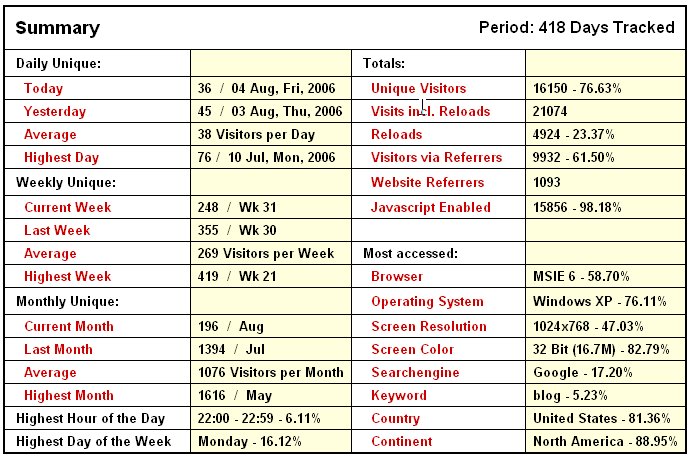
Statistics
Here's a quick snapshot of some of the statistics generated by the tracking program that monitors y'all. It's quite interesting to see the number of folks that have made their way to the IFR Pilot's little corner of the internet. Thanks for stopping by!

Accident of the Week
So, it's after 4:00 p.m. on Friday, and y'all thought the IFR Pilot wasn't going to deliver on promises of returning Accident of the Week postings, huh? Gotcha. Here's this week's doozy:
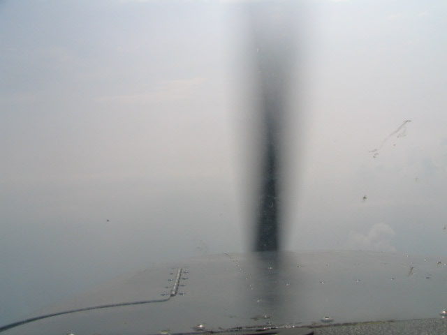
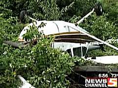
Oh, and we had another incident at the Home Base. Seems that a student pilot may have been taking off with a tail wind. She skidded off the runway and flipped the plane. Fortunately, she wasn't severely injured. But the picture sure makes it look pretty bad:
Fling-wingers, do tell: Would you feel comfortable taking off into a 150 foot overcast? Seems awfully dangerous. Even if the surrounding terrain is relatively flat, seems like you could be pretty close to plenty of cell towers, major power lines, etc. Just doesn't seem prudent to the IFR Pilot.NTSB Identification: LAX06LA247
14 CFR Part 91: General Aviation
Accident occurred Friday, July 28, 2006 in Flagstaff, AZ
Aircraft: Robinson R44, registration: N74780
Injuries: 1 Minor.
This is preliminary information, subject to change, and may contain errors. Any errors in this report will be corrected when the final report has been completed.
On July 28, 2006, about 0800 mountain standard time, a Robinson R44, N74780, collided with trees and rolled over during a forced landing near Flagstaff, Arizona. The forced landing was precipitated by a loss of engine power. Western Consulting, Inc., was operating the helicopter under the provisions of 14 CFR Part 91. The private pilot, the sole occupant, sustained minor injuries; the helicopter sustained substantial damage. The personal cross-country flight departed Flagstaff about 0755 en route to Phoenix, Arizona. Instrument meteorological conditions prevailed, and no flight plan had been filed.
The pilot departed Flagstaff under a layer of overcast clouds at 150 feet. The helicopter could not maintain altitude, so the pilot performed an autorotation into a small clearing. The rotor blades hit trees during the landing; the helicopter landed hard, and rolled over.
Oh, and we had another incident at the Home Base. Seems that a student pilot may have been taking off with a tail wind. She skidded off the runway and flipped the plane. Fortunately, she wasn't severely injured. But the picture sure makes it look pretty bad:

Subscribe to:
Posts (Atom)